
Holiday apartment in Carentan
Accommodation in Carentan
Carentan combines its role in the 1944 landings with the surrounding marsh landscape of the Cotentin. Anyone planning a trip that includes history, landscape and regional exploration can check whether a stay in Carentan fits their own itinerary.
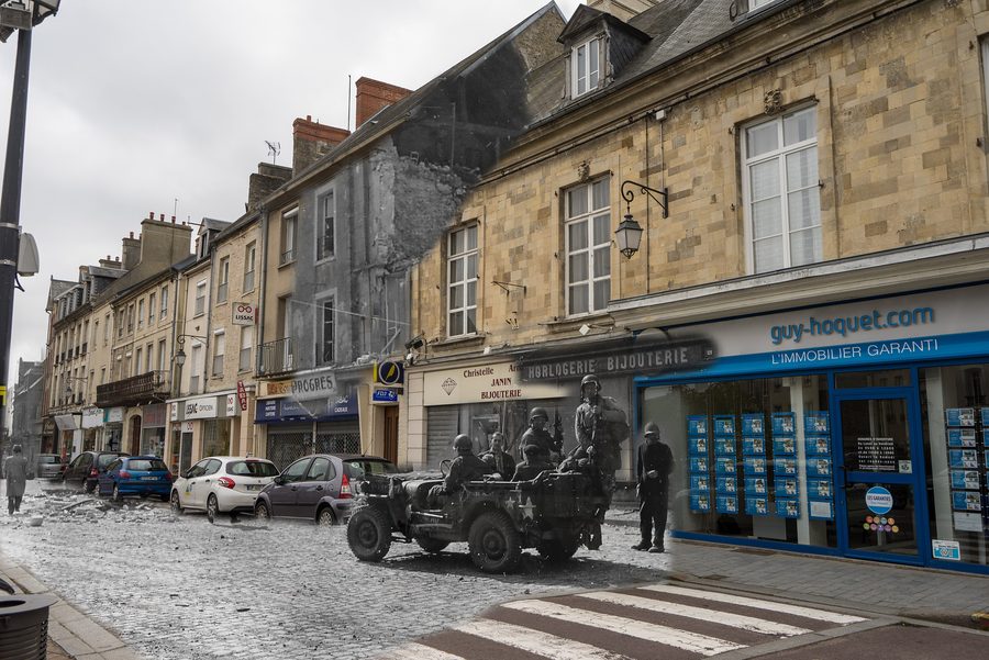 Carentan pendant la période des débarquements de Normandie, le 14 juin 1944.
Photo: Falcon® Photography from France, France via Wikimedia Commons, CC BY-SA 2.0
Carentan pendant la période des débarquements de Normandie, le 14 juin 1944.
Photo: Falcon® Photography from France, France via Wikimedia Commons, CC BY-SA 2.0
Key facts about Carentan
- Carentan is located in the Manche department in Normandy and today is a delegated commune within Carentan-les-Marais.
- The surrounding area lies between the Taute and the Douve and belongs to the broader marshland area at the entrance to the Cotentin Peninsula and the Bay of Veys.
- Carentan has a railway station on the Mantes-la-Jolie–Cherbourg railway line.
- The town played a strategic role during the 1944 Normandy landings.
A town with a historical focus
Carentan is shaped above all by its historical connection with the Allied invasion of Normandy. In 1944, the town played a strategic role, including in linking the areas around Utah Beach and Omaha Beach. This background makes the historical aspect a clear theme for a stay in Carentan.
Between town and marshland
The area around Carentan is characterised by the marsh landscape between the Taute and the Douve. The wider region is also associated with the Regional Natural Park of Marais du Cotentin et du Bessin and is described as a resting area for migratory birds. This natural setting should be understood as a regional excursion area, not automatically as an individual attraction within the town.
For the classification of Carentan, this means: the town stands for its historical significance, while the marsh landscape should be taken into account as part of the broader regional context.
Carentan as a possible base
Carentan lies at the entrance to the Cotentin Peninsula and the Bay of Veys. The town can therefore be considered one of several bases or a stop on a tour through the western part of Normandy. The railway station is on the Mantes-la-Jolie–Cherbourg line. However, short distances, specific connections or particular suitability for a specific family situation cannot be inferred from this; the current timetables and planned excursion programme should be checked separately.
When looking for a holiday apartment in Carentan, it is therefore worth checking whether the location suits your personal travel plans. If the accommodation is meant to reflect Carentan’s historical significance and include the marsh landscape in the wider surroundings, the town is a possible option. For broader guidance in the region, you can find further orientation at Manche.
Frequently asked questions about Carentan
What is Carentan suitable for as a holiday destination?
Carentan is particularly suitable for a combination of regional history, marshland and a road trip through the western part of Normandy. Its specific suitability as a family base depends on the planned programme and the verified transport connections.
Is Carentan well located for a road trip through western Normandy?
Carentan lies at the entrance to the Cotentin Peninsula and has a railway station on the Mantes-la-Jolie–Cherbourg line. For a specific road trip, current connections and the desired excursion destinations should be checked separately.
What characterises the surroundings of Carentan?
The surroundings are characterised by the marshland between the Taute and the Douve as well as the wider natural park region of Marais du Cotentin et du Bessin. This landscape should be understood as the surrounding area or an excursion area, not as an indication that all natural destinations are located in the town.

.jpg)
.jpg)